3FM Project To Deliver Final Elements Of Masterplan 2040
3FM Project stands for ‘Third & Final Masterplan’ project and it does what it says on the tin, namely providing the third and final major element of port capacity needed to deliver the objectives of Dublin Port Company’s Masterplan 2040. The other two masterplan projects, Alexandra Basin Redevelopment, which is nearing completion, and MP2, which has recently commenced construction, are focused on the North Port, whereas 3FM will be on the Poolbeg Peninsula. That area already houses the greatest cluster of major utility operations in Ireland, with the largest sewage works and the largest waste to energy plant, as well as power stations and the National Oil Reserve.
3FM will be submitted as a Strategic Infrastructure Development application to An Bord Pleanála this summer. Subject to the granting of planning permission, the completed project will bring Dublin Port to its final maximum capacity and will finish a cycle of development that began with the establishment of the first port authority 333 years previously. Dublin Port Company (DPC) has already highlighted that new port facilities will then be needed elsewhere on the east coast to cater for increased port demand post-2040 (www.dublinportpost2040dialogue.ie).
It normally takes in the order of 15 to 20 years to bring a major port infrastructure project from scheme inception through to completion. Whilst the rationale for the 3FM Project is based on the projected capacity requirements in Dublin Port by 2040, its national importance is accentuated by the lack of any projects in other Tier 1 and Tier 2 ports to deliver significant additional capacity for Ro-Ro and Lo-Lo in the future. Against this background, a failure by DPC to bring the 3FM Project forward would exacerbate an already evident risk of a national port capacity shortage between now and 2040. This is why 3FM is seen as a project of national strategic importance and why it features in Project Ireland 2040, National Ports Policy, and the National Development Plan.
3FM envisages the development of five parcels of Dublin Port lands on the Poolbeg Peninsula to, firstly, provide a total annual capacity of 12 million tonnes (split equally between Ro-Ro trailers and Lo-Lo containers) and, secondly, to provide infrastructure and facilities to support the objective to re-integrate Dublin Port with Dublin City. To put the tonnage figure in perspective, it is equivalent to three times the current throughput of Rosslare.
The main project components will be:
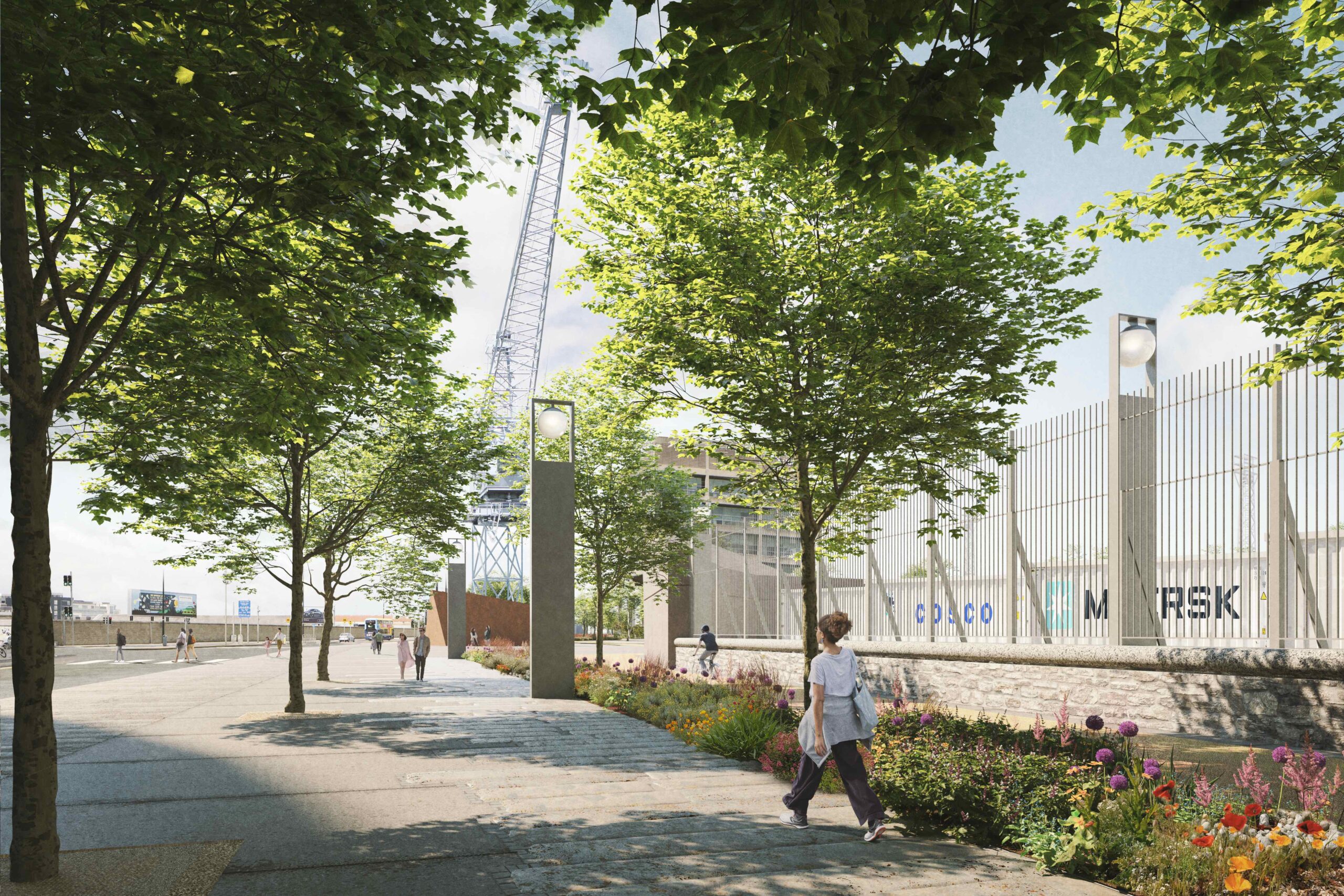
A new dedicated 2.2km long Southern Port Access Route (SPAR) to link the North Port/ Dublin Port Tunnel to the Poolbeg Peninsula. This will take heavy goods traffic off the current roads served by the Tom Clarke Bridge by providing a new dedicated route for 3FM port traffic and other heavy goods traffic on the Poolbeg Peninsula, as well as public transport. The SPAR will include a new lifting bridge over the Liffey, to the west of the Tom Clarke Bridge, and will also have a substantial ‘active travel’ provision as well as a reservation strip for a future LUAS connection to Poolbeg.
A new Lo-Lo container terminal (Area N) in front of the Poolbeg Power station. This will be the largest such terminal in the country and will have access to new deeper berthage at the east of the port. This terminal will primarily handle exports and will be linked to an additional terminal yard (Area O) on the south side of the Peninsula which will service Lo-Lo imports. The combined terminal will cover 15 hectares.
Creation of the new Lo-Lo terminal will then allow relocation there of the existing Lo-Lo container operations (Area K) which are just to the north of the Sean Moore Roundabout. That existing terminal will then be converted to a 12.6 hectares Ro-Ro terminal for the increasing volumes of traffic coming direct from Europe post-Brexit.
A new 325-metre turning circle for ferries at the eastern end of the port, immediately adjacent to
the existing Irish Ferries terminal. This has been the subject of extensive ship simulation modelling and will allow turning of 240-metre long ferries, the largest in class vessels.
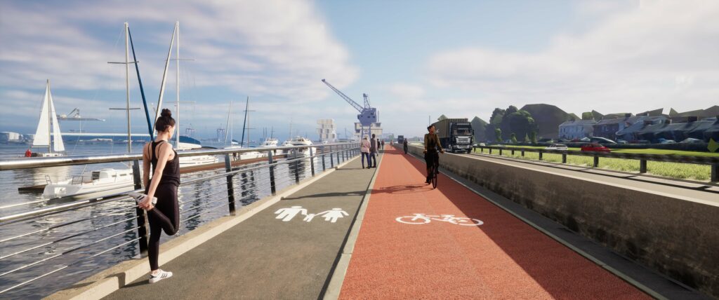
A Sailing & Rowing campus of 1.9 hectares on the south side of the Liffey, known as the ‘Maritime Village’, which will replace the current much smaller facilities to the east of the MTL terminal. The Maritime Village will provide facilities for a range of users, including sailing and rowing clubs, Sea Scouts, the Nautical Trust and local boat owners. It will include a public plaza and a significantly expanded marina.
A Port Park and landscaped zone of 2.7 hectares immediately to the east of the Glass Bottle development. This will include all-weather sports surfaces, as well as other facilities such as a ‘dog run’.
Utility Area of 1 hectare adjacent to Port Park – for district heating and local service needs.
5.5 kilometres of active travel path/ greenway for pedestrians and cyclists, taking them from North Wall Quay, beside the Point Roundabout, through to Pigeon House Harbour at the heart of the Poolbeg Peninsula. At North Wall Quay, this will link with the 1.4-kilometre Liffey Tolka active travel route which DPC hopes to commence in 2024. This 1.4-kilometre route will bring pedestrians and cyclists as far as the Tolka Estuary, where they can then connect with the 3.2-kilometre Tolka Estuary Greenway that DPC is currently constructing. Separately, 3FM will also include 3.1 kilometres of new or upgraded footway.
DPC has been working on developing and evolving the 3FM design over the last two years – on what is a very large and complex project with multiple stakeholders and interested parties. So as to get feedback on its developing design, we held a first round of public consultation at the end of 2021, and a second round of consultation was held in spring 2023 – as the design became more fully evolved in the lead-up to a planning application to An Bord Pleanála in summer 2023.
If granted planning permission, the 3FM Project will be delivered by way of a series of sub-projects for a number of reasons:
This is the approach specified in Masterplan 2040.
The transition of the existing container terminal operations from Area K to the new proposed terminal at Area N and Area O will need to be managed to ensure no loss of overall port throughput capacity. Work on the new Ro-Ro terminal at Area K could not proceed until the new Lo-Lo terminal was fully operational.
The development of the sailing and rowing campus will need to be completed, so that there is minimal or no disruption to existing activities during construction.
Parts of the overall project lands of c. 34 hectares will need to be used as construction compounds while works elsewhere are being completed.
It may be appropriate to defer the planned timings of construction of some sub-projects, depending on the evolution of demand patterns over time.